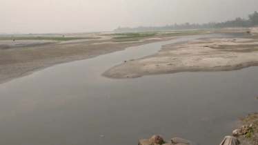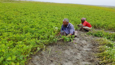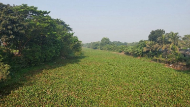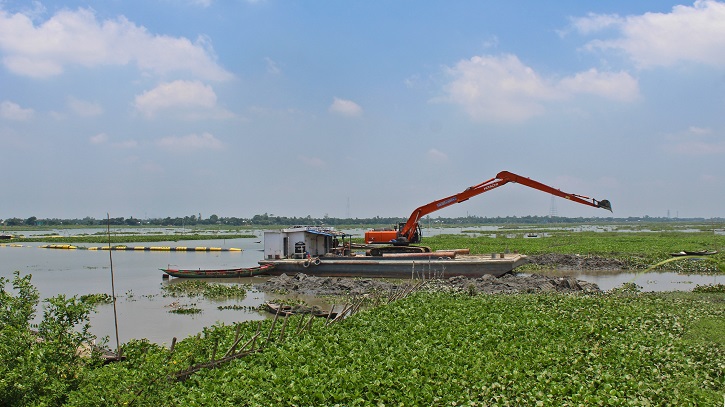
Over the last two decades, Bangladesh has spent a large amount of money to restore its waterways by dredging the rivers across the country to clear some silt and sand. The government planned to make the waterways navigable for carrying goods and passengers, to reduce the pressure on roads and transportation costs. Source: Mongabay
According to the Bangladesh Inland Water Transport Authority (BIWTA), out of Bangladesh’s 24,000 kilometers (14,900 miles) of waterways, only about 6,000 km (3,730 mi) are navigable by mechanized vessels during the monsoons. During the dry seasons, this shrinks to about 3,800 km (2,360 mi).
In an effort to expand the waterways and ensure navigability throughout the year, Bangladesh Water Development Board (BWDB) — under Bangladesh’s ministry of water resources — and BIWTA — under the shipping ministry — have been jointly managing the capital and maintenance of dredging every year for two decades under a master plan. This project is dependent on public money.
Plans for dredging
Capital dredging is a method of creating new waterways by increasing the depth of a channel by dredging, while maintenance dredging is a regular activity to clear silt and sediment from the channels of bigger rivers.
As per the master plan announced in 2012, 178 rivers are supposed to be dredged gradually over time to maintain regular navigation channels and create 10,000 km (6,213 mi) of new waterways. Of them, 53 rivers would be dredged under capital dredging initiatives. As part of the plan, the authority initially started river dredging activities in 24 rivers during the first phase.
For instance, in 2018, BIWTA took on a dredging project to restore four rivers — Old Brahmaputra, Tulai, Dharla, and Punarbhaba — with a budget of $370 million (43,710 million takas) under a dredging initiative. Of them, the plan for Old Brahmaputra was to dredge 227 km (141 mi) of the river from its off-take in Jamalpur to Kishoreganj with a budget of $231 million (27.63 billion takas).
Between May 3 and 17, Mongabay visited at least 40 points along the Old Brahmaputra, Tulai, Dharla and Punarbhaba rivers and found no exceptional development in waterway restoration. Moreover, the locals living close to the banks expressed frustration about the dredging work, saying they believe it has hampered their lives and livelihoods.
Another important ongoing dredging work is the restoration of the Indo-Bangladesh Protocol Route — the transboundary river route between Bangladesh and India — between Narayanganj district and Chittagong district, funded by a World Bank loan. In 2022, BIWTA awarded a $71 million (8.5 billion takas) contract to a Chinese company to dredge 800 km (497 mi) of rivers to boost transport routes via Bangladesh between mainland India and its northeastern states.
A major part of this route is via the Meghna River. Mongabay visited several points along the navigation route between May 25 and 27 and found most of them have remained the same as before, where the plying of large vessels seems impossible.
As per BIWTA’s 2017 notice, between 2009 and 2017, the country restored an estimated 547 km (340 mi) of waterways for all seasons. Furthermore, BIWTA’s 2022-23 annual report states that between 2010 and 2023, the volume of 3,700 km (2,300 mi) of waterways increased.
However, when Mongabay compared the government’s declaration on its website and the reality in the field, we found that the can be termed ‘only on paper’ in many cases. Two of the projects were examined more closely to investigate the reality.
The reality in Old Brahmaputra
Among all the dredging activities, the 227 kilometer-long (141 mile-long) dredging work in the Old Brahmaputra River between Jamalpur district and Kishoreganj district is the significant one. Our investigation found the project failed to improve navigation, and rather raised serious concerns about its execution and environmental impact among the riverside communities.
Dredging is intended to deepen waterways, improve navigation and maintain water flow. However, when conducted improperly, it can disrupt ecosystems and damage agricultural land.
A local farmer and seasonal boatman in Mymensingh district, Sirajul Islam, said he is frustrated because, despite the completion of the dredging project, the river’s water levels remain shallow, obstructing the passage of boats and other vessels.
“The dredging has been done, but there’s no change in the water level. It’s still too shallow for boats to navigate properly,” Siraj said. He said that the dredging contractor may not have followed proper procedures, which resulted in environmental damage.
“The contractors seem to have taken the dredged sand and dumped it on nearby agricultural lands, damaging the crops.”
Siraj’s concerns highlight significant issues with the effectiveness and environmental impact of the dredging project.
Moni Bin, a long-time resident of the riverbank, has witnessed the gradual decline of the waterway over the past two decades. Her riverside tea stall, once bustling with boatmen and passersby, faces a new issue — dust pollution. Sand dumped and transported by trucks has choked the air with dust, causing respiratory problems for Moni and others in the community, particularly children and the elderly.
“The dust hinders even basic chores like washing dishes and doing laundry, and it contaminates our food,” she said.
Local people from Jamalpur district shared similar sentiments to those of the residents from Mymensingh. “The authority claims the dredging is for our benefit, but our crops suffer from the sand dumped on our fields,” said Estellah, a farmer.
“The dredging disrupts the natural river flow, causing unpredictable water levels. It’s become impossible to cultivate crops properly anymore,” he said.
The incomplete and improperly conducted dredging has rendered the project ineffective, causing many problems locally. Shallow waters hinder navigation, dumped sand harms crops, dust pollution creates health problems, and altered waterflow disrupts irrigation.
And how have Dharla, Tulai and Punarbhaba fared?
Far from benefitting from the dredging, the people who live on the banks of Dharla, Tulai and Punarbhaba rivers describe various difficulties and anomalies that are a result of these activities.
Raisul Islam, a fisherman from Kakaidanga in the Biral region of Dinajpur district, catches fish from the Punarbhaba River. Lately, he is facing a hard time as the river has dried up at many points due to a lack of water flow, forcing the fish to disappear.
“Now I cannot catch even one kilogram of fish in a day as there is not enough water, and fish, in the river. If the whole river had been dredged to ensure its water flow, fish would have returned to the river,” he said.
Another fisherman* from Dinajpur Sadar on the Punarbhaba riverbank, said, “The river is being dredged only in some points while most of the river has remained the same. River dredging continues here only for sand trade. The river is being dredged in only such points where there are enough road connections to supply sands extracted from the river.”
Md. Al Amin, a resident who lives on the Dharla riverbank, said the authorities have been storing the dredged sand on the riverbanks. “Once the rain comes, the sands stored on the riverbanks return to the river as runoff, resulting in a filled up riverbed,” he said.
“They dredged about 200 feet last year and deposited the sand on its bank, and later the sand was sold via leases. However, the dredging itself did not benefit the river or the people. The way the river is being dredged every year will not bring any benefit at all,” said a resident* of the Tulai Riverbank.
Regarding the government’s claim on new waterways through dredging and our findings, Mongabay tried to contact former brigadier general M. Sakhawat Hussain, advisor to Bangladesh’s ministry of shipping, and BIWTA’s chief engineer Rokibul Islam Talukder and additional chief engineer Md. Saidur Rahman several times via phone calls, text messages and emails but failed to get any comments.
The Protocol Route and the rivers’ economic importance
Due to the economic benefits and to lower the carrying cost of goods between Bangladesh and neighboring India, a protocol for using Bangladesh’s waterways was signed in 1972.
As per the protocol, the primary goal of the agreement is to enhance economic growth between the countries. By increasing its trade with India, Bangladesh would benefit from the services it offers to Indian vessels during their voyage, which would further facilitate growth in their service industry and enhance other logistics and businesses. Since Bangladesh is looking for opportunities to export to India’s northeastern states, the protocol opens various opportunities for Bangladesh to strengthen its trade, which will, in turn, generate revenues.
However, due to the rivers’ lack of navigable depth and cargo operators’ interest, the number of inland waterway traffic movements between Bangladesh and India has not yet reached a satisfactory figure.
Data shows that only 3 of the 11 declared routes are used regularly, and the rest are used irregularly. Some are not used even once a year.
The unused Protocol Route results from poor navigability and less demand, said Maminul Haque Sarker, senior advisor on river, delta and coastal morphology at the Center for Environmental and Geographic Information Services (CEGIS).
Manimul blamed poor navigability as the main cause of the protocol route’s ineffectiveness. “Most routes carry huge amounts of sediment, reducing the cargo ships’ navigability. Secondly, the demand for the routes is not created for the users as the routes cannot be compatible with larger vessels. Naturally, the operators often cannot be interested as running small vessels cannot guarantee them the profit from the trips,” he said.
Waterway transportation is known for being cost friendly and environmentally friendly, making it the best alternative to land routes. A 2016 World Bank study showed that carrying one ton of goods per kilometer (0.62 mi) costs $0.0083 (0.99 taka) via waterways, $0.023 (2.74 takas) when transported via railways, and $0.038 (4.50 takas) by road.
Why is the dredging not panning out?
A large part of Bangladesh is an active delta formed by the sediments carried by the rivers flowing down from the Himalayan region. Bangladesh and India share at least 54 such rivers in common and agriculture, navigation, inland fisheries and other economically significant activities are hugely dependent on these rivers’ waters.
Data from a 2021 study shows that, annually, these rivers and water bodies carry around 2.4 billion tons of sediments like sand, clay and silt.
Dredging is an integral part of Bangladesh’s river system maintenance. It has long been used to maintain the busy channels in major rivers like the Ganges, Brahmaputra and Meghna.
Saiful Alam, former director general of Bangladesh’s Water Resources Planning Organization (WARPO), said that dredging in the deltaic nation’s rivers is necessary to clear the waterways for the monsoon and winter seasons. However, the government’s implementation of river dredging is not properly scientific, which ultimately makes the expenditure a misuse of money, he said.
Citing the example of Old Brahmaputra river dredging, the water resource specialist added, “The ongoing dredging in the river is not scientific, as the authority dredges primarily on those portions of the rivers where water availability is more than the other drier parts. At the same time, the confluence of the river at the source is completely closed during dry periods, which fails to ensure the flow.”
The dredgers lift the sand from the riverbed and stack it on the banks directly, which eventually wash into the river with rain. The same scenario has been seen in almost all the dredging projects in the country. Consequently, money is spent on all these projects, but navigability is not ensured, Saiful said.
Hydrology expert Ainun Nishat, former vice-chancellor of BRAC University, agreed with Saiful. He said that, besides extensive dredging work, the rivers need proper management, like maintaining channels and protecting embankments. Otherwise, he said, silts will close the channels within a short time.
Both water resources experts are doubtful about the government’s claims. They said they are also confused about the volume of new waterways as they have not seen such new waterways in the near past.


